Produkty
menu item
Prospect
Odhadnite solárny potenciál vašej lokality
menu item
Evaluate
Time Series a TMY dáta pre optimálny dizajn elektrárne
menu item
Monitor
Hodnotenie fotovoltického výstupu v reálnom čase
menu item
Forecast
Predpoveď výroby solárnej energie na až 14 dní
menu item
Analyst
Spravujte všetky solárne dáta na jednom mieste
menu item
Integrácie
Automatizujte dodávku Solargis dát
Príklady použitia
menu item
Výber lokality
Nájdite správnu lokalitu pre váš solárny projekt
menu item
Simulácia energetického výnosu
Analyzujte potenciálne zisky a riziká
menu item
Optimalizácia návrhu elektrárne
Nájdite optimálny dizajn pre vašu solárnu elektráreň
menu item
Skutočný výkon elektrárne
Poznajte skutočný výnos vašej elektrárne
menu item
Predpoveď výkonu
Predpovedajte výnos z vášho solárneho projektu
menu item
Overenie pozemných dát
Overte si kvalitu solárnych a meteo meraní
Hodnotenie solárneho zdroja a meteorologických dát
Detailné hodnotenie a validácia solárneho zdroja
Prispôsobenie modelov Solargis lokalite
Kombinácia satelitných dát s lokálnymi meraniami
Kontrola kvality solárnych a meteorologických meraní
Oprava chýb v dátach z pozemných meraní
GIS dáta na mieru
Solargis GIS dáta prispôsobené pre vaše aplikácie
Posúdenie energetického výnosu z fotovoltiky
Odhadnite neistotu vstupných dát
Hodnotenie výkonu fotovoltiky
Odhad energie pre refinancovanie alebo akvizíciu
Štúdia PV variability a optimalizácie skladovania energie
Pochopte variabilitu výstupu naprieč regiónmi
Regionálna štúdia potenciálu solárnej energie
Identifikácia lokalít pre solárne elektrárne
menu item
Prospect
Odhadnite solárny potenciál vašej lokality
menu item
Evaluate
Time Series a TMY dáta pre optimálny dizajn elektrárne
menu item
Monitor
Hodnotenie fotovoltického výstupu v reálnom čase
menu item
Forecast
Predpoveď výroby solárnej energie na až 14 dní
Naša expertíza
Ako naša technológia funguje?
Metodológia
Ako preklápame vedu do technológie?
Knowledge base
Release notes
Príbehy klientov
Blog
Ebooky
Webináre
Publikácie
Udalosti
Bezplatné mapy a GIS dáta
O spoločnosti Solargis
Partneri
ISO certifikáty
Kariéra

Táto stránka zatiaľ nie je preložená do slovenčiny. Pozrieť si ju môžete v angličtine.

New generation Solargis Evaluate: data, PV design & simulation, analysis, and reports in one cloud-based solution. Discover more ->

At Solargis, we’ve just released Solarmaps: a new solution designed to empower PV power plant portfolio managers, operators, and analysts.

Solargis Solarmaps provides timely and accurate insights into the monthly availability of solar resource, air temperature, precipitation (rainfall), and wind speed — key factors that influence PV power plant performance.

In this article, we share what Solarmaps is and how it can support your PV portfolio management.

Diagnosing PV performance in context

Are you considering environmental effects in your PV plant performance evaluation? When performing an initial diagnosis of PV asset performance, the Solargis Solarmaps interactive map offers a complete geographical context of solar and meteorological events. This helps you understand whether your PV system performed in line with actual weather conditions, enhancing transparency and accountability in PV asset management.

Solarmaps allows you to pinpoint specific weather-related events and link them to your PV plant’s performance in the previous month. You can either explore a world map overview or select a precise location (up to three sites) to access localized data.
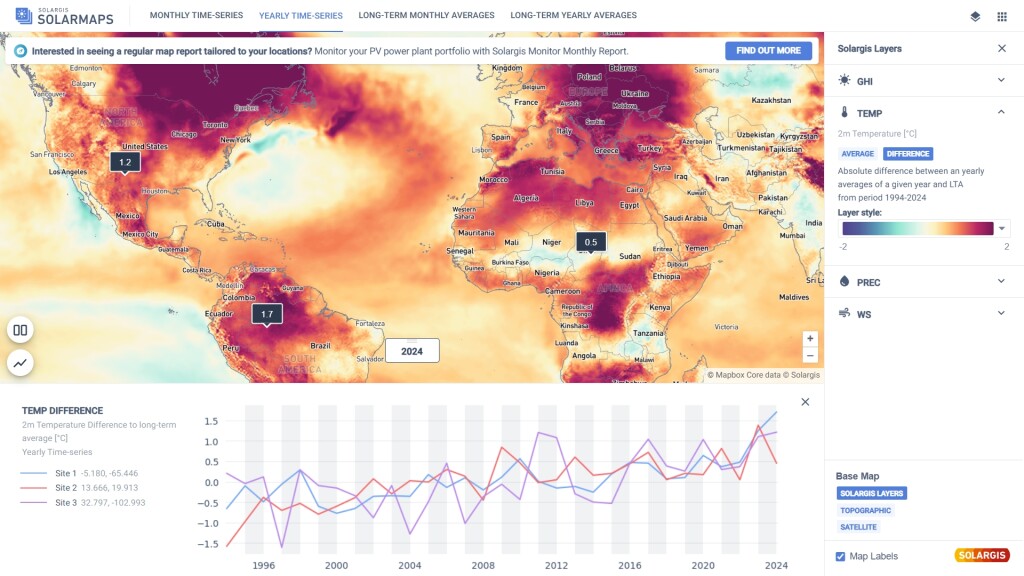
yearly time series solarmaps

What data can you access in Solargis Solarmaps?

In the upper banner of the Solarmaps interface, you’ll find tabs displaying different data aggregations. Depending on the selected tab, the map layer updates to show the corresponding values.

For the latest month and the latest calendar year:

  • Monthly & yearly summary of Global Horizontal Irradiation (GHI)
  • Monthly & yearly GHI difference vs. long-term average
  • Monthly & yearly average air temperature (2 metres)
  • Monthly & yearly air temperature difference vs. long-term average
  • Monthly & yearly precipitation summary
  • Monthly & yearly precipitation difference vs. long-term average
  • Monthly & yearly average wind speed
  • Monthly & yearly wind speed difference vs. long-term average

Long-term monthly and annual averages:

  • GHI
  • Air temperature
  • Precipitation
  • Wind speed

When new data for a recent month becomes available, the existing monthly dataset will be replaced with the most recent month. At any given time, only data for the previous month is accessible.

Key features of Solargis Solarmaps

1. Site-specific data

To view precise, site-specific data for the previous month, simply click on the map to locate your projects. You can select up to three sites at once. Values for the previous month can be compared with long-term averages, helping you attribute deviations in performance to environmental conditions.

The same applies to yearly data. Simply switch the tab in the upper menu from monthly to yearly time-series to access last year’s values.
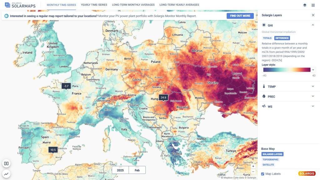
monthly time series solarmaps

2. Custom value range

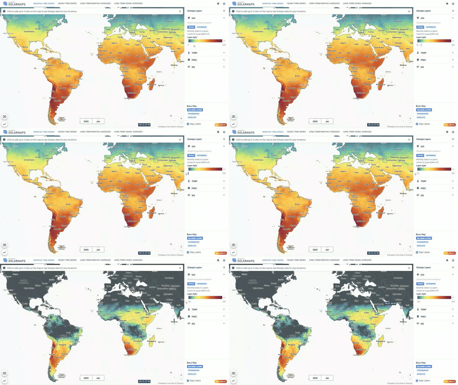
Once a map layer is selected, you can customize the color scale for the selected parameter for better visualization. This helps highlight areas that are in line with your desired range. To adjust the range, edit the values under the Style section on the right-hand side.
3. Split view

With the split view feature, you can divide the map window into two panels and compare selected variables side by side. This allows you to analyze the correlation between monthly air temperature and GHI in one screen and assess its impact on monthly PV performance.
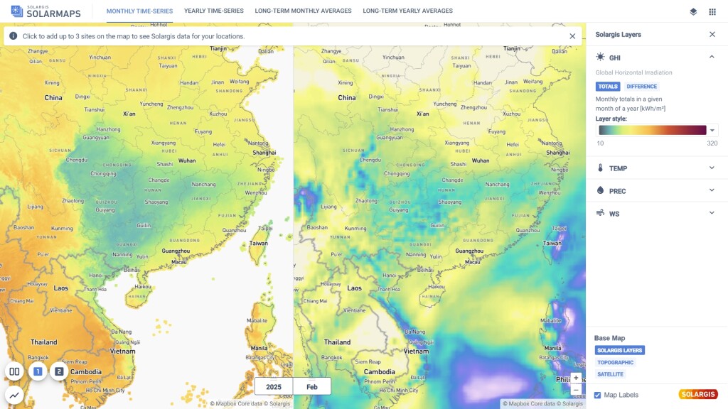
split view solarmaps

4. Graphs

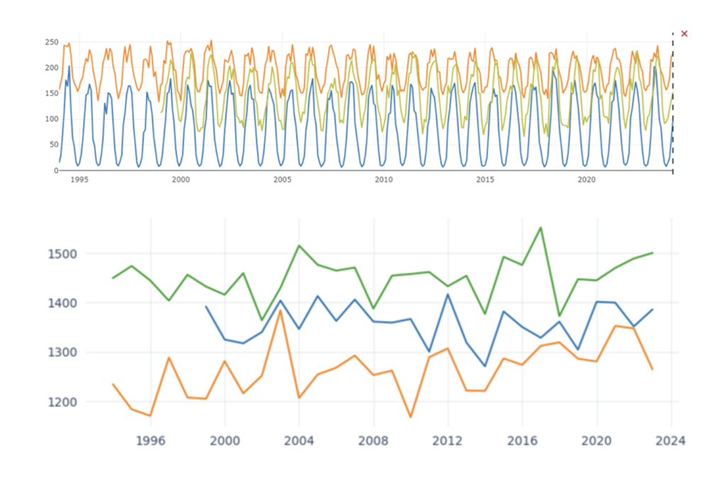
You can select up to three sites and display them in a graph to visualize the full history of monthly or yearly time series data. This makes it easy to spot cyclic changes and seasonal trends. Graphs can be exported in PNG format with a simple right-click for use in reports and presentations.
Solargis solarmaps graphs

How can I access Solargis Solarmaps?

Only Solargis customers can get access to Solargis Solarmaps. The application is automatically available to anyone with an active subscription to any Solargis solution.

Access your account here: https://apps.solargis.com/ 

Keep reading

Precipitable Water (PWAT) - new data parameter
Solargis news

Precipitable Water (PWAT) - new data parameter

Precipitable water or ‘PWAT’ in short, is the depth of water in a column of the atmosphere if all the water in that column were precipitated as rain.

Training in Beijing: sharing our knowledge with chinese professionals and the public
Solargis news

Training in Beijing: sharing our knowledge with chinese professionals and the public

We shared our knowledge with professionals in the solar energy industry in China during Assessment of solar resource measurement technology exchange event.

Annual average values of solar resource and temperature are now available for free via iMaps
Solargis news

Annual average values of solar resource and temperature are now available for free via iMaps

From today onwards, we are also opening access to long-term annual averages of key solar parameters GHI, DIF, and DNI via Solargis iMaps prospecting tool.