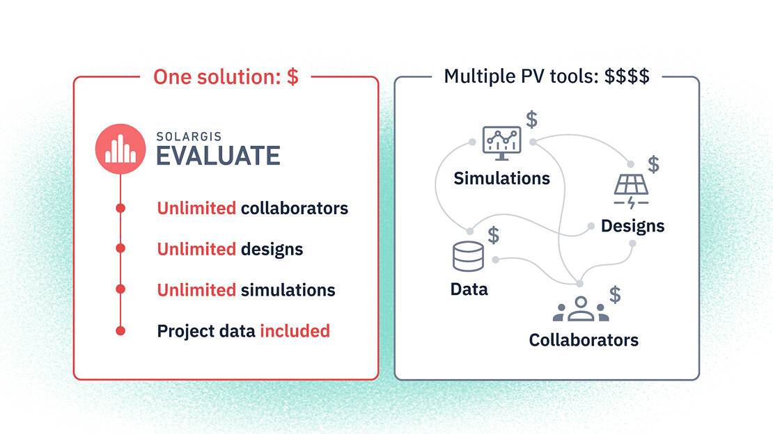
Approximately one year ago, we launched Solargis Evaluate packed with features for complex site assessment, PV system design, energy yield simulation, analysis, and reporting, all under one roof.
Our latest Evaluate 2.7 release is expanding on what you can already do in Evaluate, introducing major improvements in the PV system designer, data analysis, and bankable reports. Get to know them below.
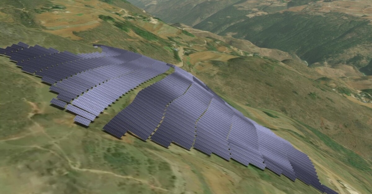
Designing PV power plants on uneven terrains often meant compromises. Many teams either simplified the terrain or accepted less accurate layout and shading assumptions.
We previously introduced terrain-adapted PV layout for fixed-mount systems so you can design PV power plants that conform to the natural contours of the land without flattening the terrain. Now, we’re extending the same capability to tracker PV systems as well.
In the 3D Energy System Designer, PV tables can follow real-world undulations while respecting clearance and orientation, helping mitigate common challenges of complex terrain such as erosion risk, excessive ground works, and construction complexity.
Because layout decisions on uneven ground directly influence shading and electrical behavior, the simulation runs at cell level, enabling accurate inter-row shading-loss calculations even on challenging sites.
With the new smart collision detection, Evaluate checks your design in real time. After every adjustment to the design, the platform automatically evaluates interactions between PV tables, terrain, and inverter units, and highlights problematic areas directly in the scene.
You can fix issues while you design, before they turn into late-stage redesigns, constructability questions, or conservative spacing decisions that increase cost.
Cabling is one of the most “quietly expensive” parts of PV design, especially when routes become longer or more complex due to terrain. Evaluate 2.7 introduces a new Cable design feature that connects two things that belong together: the route you draw, and the cable you size.
When you edit the route, the sizing table updates cable types based on distance and electrical requirements. Cable length calculation respects terrain shape and burial depth, and sizing follows IEC 60287, helping you select cables that meet three essential criteria:
The result is a design workflow that is more aligned with engineering practice, while staying tightly connected to your quantities and CAPEX assumptions.
Evaluate already includes built-in validation to catch issues such as voltage mismatches, incorrect inverter settings, or grid connection inconsistencies.
In the 2.7 release, validation becomes more proactive: as you design, the system checks validity in real time, helping you identify and resolve problems earlier, before they ripple into performance risk or rework during EPC handover.
Evaluate 2.7 adds a new Inverter statistics section in analytics, designed to help you quickly identify bottlenecks, quantify losses, and make informed decisions to increase yield and return on investment.
The new view tracks how often your system operates in four key states:
Evaluate 2.7 strengthens reporting with a new vector-based 2D power plant layout embedded directly in project reports.
The layout helps stakeholders quickly verify site assumptions and component placement. This is useful not only for engineers, but also when explaining the project to permitting authorities, investors, EPC partners, and landowners. The map supports deep zoom for detail inspection and includes essential context such as coordinates, north arrow, legend, and base map.
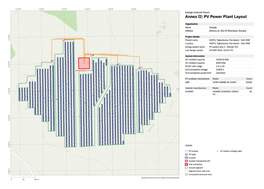
Crucially, the layout is tied to a unique report ID and digitally signed. Any third party can verify that the drawing corresponds exactly to the calculated yield, Bill of Materials quantities, and CAPEX assumptions.
Download sample reports and data here.
Solargis Evaluate 2.7 is designed to make your design decisions more realistic, more engineering-aligned, and easier to validate, especially in the types of sites where assumptions tend to pile up: undulating terrain, dense layouts, and grid-constrained environments.
With terrain-adapted layouts, collision checks, integrated cable design, real-time validation, inverter statistics, and stronger report visuals, this release helps you move from concept to bankable design with more confidence and fewer surprises later down the line.
Want to learn more? Contact us.