选址
扫描并比较数百个潜在地点。深入分析太阳能潜力最大的地点。挑选最有潜力的地点。

全球各地的太阳能项目机会如此之多,要做出正确的选址选择却越来越难。
实时掌握有关潜在场址的正确信息,可以让您灵活地对报价和要求做出快速反应。
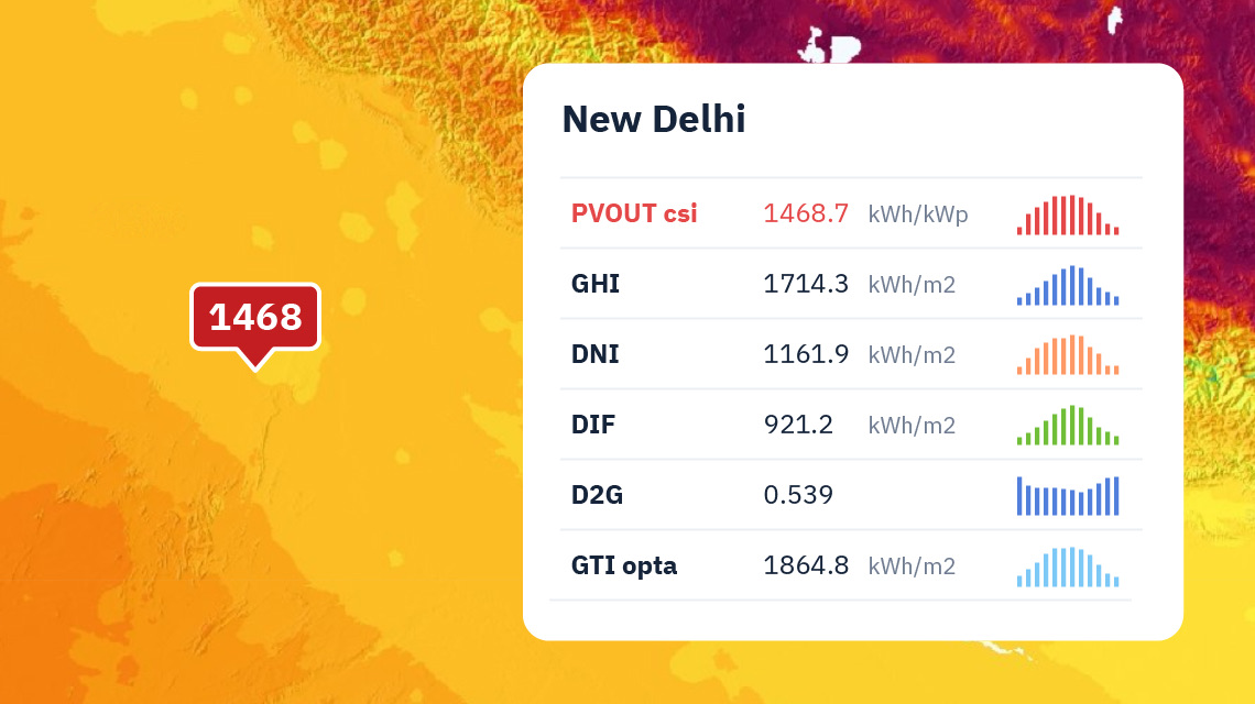
场地的位置和条件直接影响太阳能项目的投资回报率。利用我们的卫星技术和天气模型,您可以获取任何地点的深入数据,而无需进行现场测量。
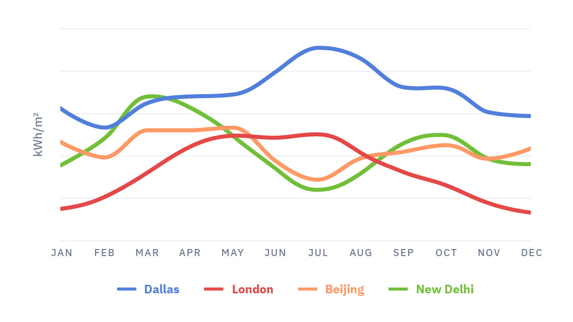
这样,您就可以有效地比较多个地点和机会以及各种技术配置,并挑选出回报率最高的地点。
地理和气候条件多种多样,即使相距很近的地点之间也可能存在差异。
高空间分辨率和定期更新的地图对于确定具体地点的条件和为太阳能项目选择最佳候选地至关重要。
有了一套完整的参数,您就可以根据科学依据而不是 "经验之谈 "的假设,提出技术上合理的建议。
在您自己的应用程序中探索太阳能、气象和光伏发电潜力的 GIS 数据。
您可以在所有具有光栅数据处理功能或数值实现功能的通用 GIS 软件(GeoTIFF、NetCDF 等)中使用太阳能资源、光伏发电、气候和其他地理数据进行分析和可视化。
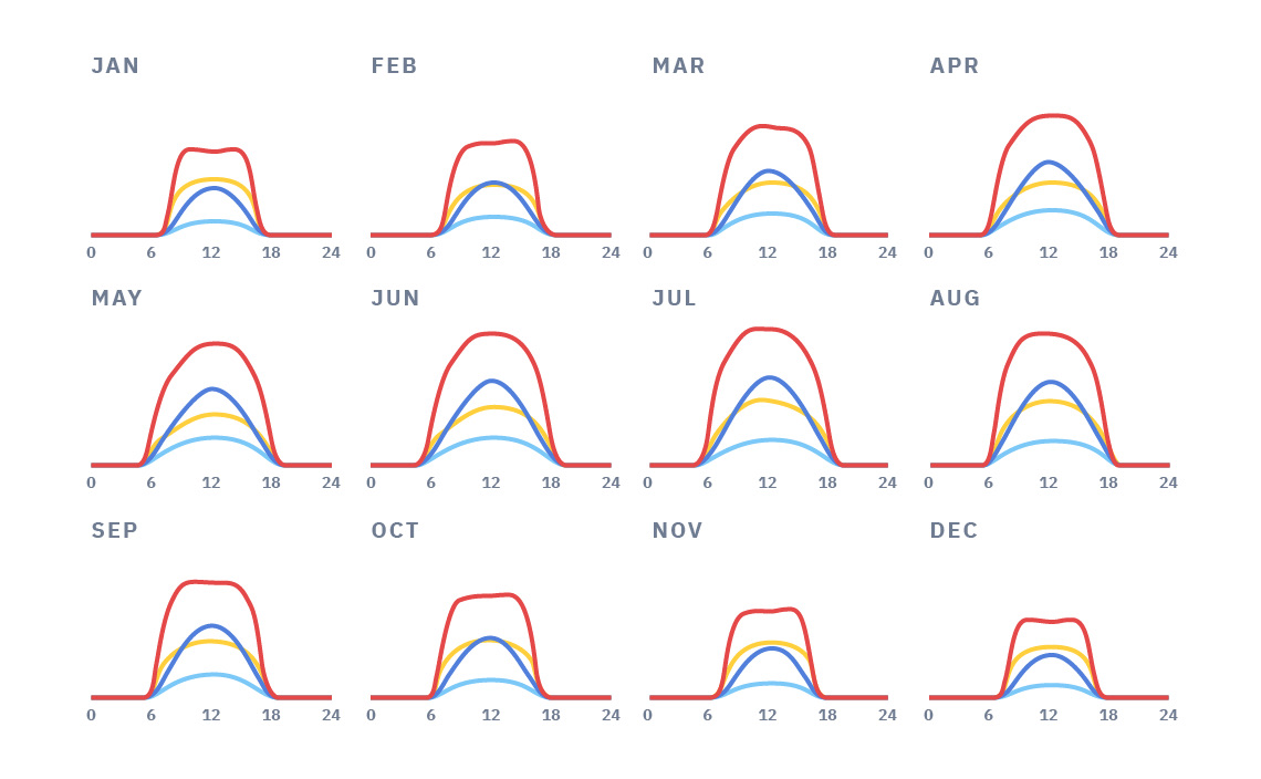
在区域太阳能潜力研究中,我们不仅分析了太阳能资源信息,而且分析了气象和地理数据。
分析考虑了资源估计的不确定性、间歇性和季节性变异性、极端天气以及太阳能发电厂部署的地理限制。
Solargis 为谷歌地球发布了 kmz 格式的 GHI、DNI 和 PVOUT 地图。
在 Solargis,我们支持了太阳能行业十年的发展,并将继续支持其过渡到后补贴开发和运营的新阶段。在这种不断变化的环境中降低风险需要注重效率。太阳能资产所有者希望在太阳能和气象数据最新发展的支持下,最大限度地利用其项目。
随着印度对商业和工业太阳能项目的需求持续增长,高分辨率气象数据至关重要。
每年由我们的银行可担保太阳能和气象数据、软件和服务支持的项目
在太阳能项目和提高行业标准方面拥有多年经验
覆盖全球人口的 30 年太阳和气象数据


